


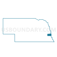
Weeping Water 2nd Ward, Cass County, Nebraska
About
Outline

Summary
| Unique Area Identifier | 612540 |
| Name | Weeping Water 2nd Ward |
| County | Cass County |
| State | Nebraska |
| Area (square miles) | 17.79 |
| Land Area (square miles) | 17.74 |
| Water Area (square miles) | 0.04 |
| % of Land Area | 99.75 |
| % of Water Area | 0.25 |
| Latitude of the Internal Point | 40.85802430 |
| Longtitude of the Internal Point | -96.18164860 |
Maps


Graphs
Select a template below for downloading or customizing gragh for Weeping Water 2nd Ward, Cass County, Nebraska


Neighbors
Neighoring Voting District (by Name) Neighboring Voting District on the Map
- Avoca Precinct, Cass County, NE
- Center Precinct, Cass County, NE
- Elmwood Precinct, Cass County, NE
- Stove Creek Precinct, Cass County, NE
- Weeping Water 1st Ward, Cass County, NE
Top 10 Neighboring County Subdivision (by Population) Neighboring County Subdivision on the Map
- Weeping Water city, Cass County, NE (1,050)
- Stove Creek precinct, Cass County, NE (992)
- Avoca precinct, Cass County, NE (596)
- Center precinct, Cass County, NE (527)
- Weeping Water precinct, Cass County, NE (137)
Top 10 Neighboring Place (by Population) Neighboring Place on the Map
Top 10 Neighboring Unified School District (by Population) Neighboring Unified School District on the Map
- Syracuse-Dunbar-Avoca Schools, NE (4,454)
- Elmwood-Murdock Public Schools, NE (2,030)
- Weeping Water Public Schools, NE (1,873)